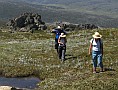
 As you will be starting early, when it’s probably cold and misty, it’s important to warm up thoroughly, gently stretching muscles that will be put to the test over the long day.
It should be possible to make good progress for the first hour, as the old Summit Road climbs very gradually along the south-eastern rim of the valley above the Snowy River. The road was only closed to vehicles in 1982, and now conveys thousands of walkers and mountain bikers to Rawson Pass each summer.
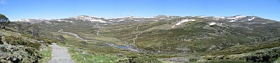
The snow gums of Charlotte Pass are soon left behind, and the remainder of the walk is above the tree line. More of this fascinating heath-and-granite landscape is revealed as the mist starts to clear, including the grandeur of the Main Range: the chain of peaks forming the Great Dividing Range on the other side of the valley. The tallest of these is Mt Townsend.
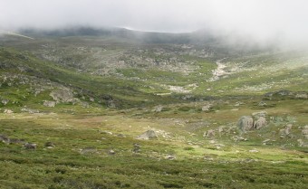
Mist shrouds the course of Club Lake Creek
 3.8km
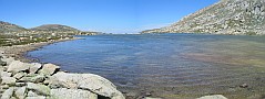
After about an hour of brisk walking you reach a crest and the landscape opens out into a huge, shallow bowl, the cradle of the famous Snowy River. The road descends to two bridges, the first crossing Merritts Creek and the second the Snowy. Pause to read about the native galaxias, still found in these waters but out-muscled by introduced trout downstream.
3.8km
After about an hour of brisk walking you reach a crest and the landscape opens out into a huge, shallow bowl, the cradle of the famous Snowy River. The road descends to two bridges, the first crossing Merritts Creek and the second the Snowy. Pause to read about the native galaxias, still found in these waters but out-muscled by introduced trout downstream.
A line of snow poles may be apparent as you gaze up the valley from the bridges, marking the return route for walk A1B.
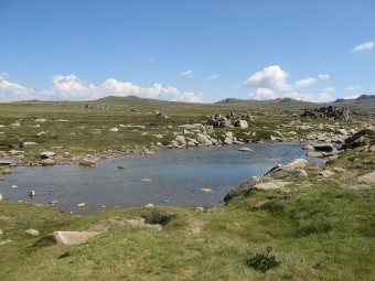
Snowy River at Summit Road
Seamans Hut is visible on the horizon, a beacon beckoning you up the 1.5km climb to the end of Etheridge Ridge.
 6.0km
In the winter of 1928 two friends skied together to Mt Kosciuszko, but returned by different routes. Laurie Seaman perished nearby, found in a sitting position months later. The body of his friend, Evan Hayes, was only discovered at Lake Cootapatamba at the end of 1929. The hut erected by Seaman’s parents has sheltered many skiers and walkers since then. Spend a few minutes inspecting the interior of the hut before continuing west towards Rawson Pass.
6.0km
In the winter of 1928 two friends skied together to Mt Kosciuszko, but returned by different routes. Laurie Seaman perished nearby, found in a sitting position months later. The body of his friend, Evan Hayes, was only discovered at Lake Cootapatamba at the end of 1929. The hut erected by Seaman’s parents has sheltered many skiers and walkers since then. Spend a few minutes inspecting the interior of the hut before continuing west towards Rawson Pass.
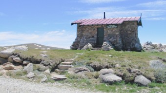
Seamans Hut