 11.0 (13.0) km
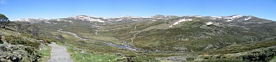
Although the climb from Albina Pass to Northcote Pass is not very steep, track conditions become more difficult. Mt Northcote lies along a band of shales, and as the track traverses the steep slope it cuts a narrow path into the rock. The many stony fragments increase the risk of slipping, and walkers should be vigilant despite (actually because of) the wonderful view ahead. Lake Albina sits on a ledge below the craggy face of Mt Townsend and Alice Rawson Peak, and above the ravine known as Lady Northcotes Canyon.
11.0 (13.0) km
Although the climb from Albina Pass to Northcote Pass is not very steep, track conditions become more difficult. Mt Northcote lies along a band of shales, and as the track traverses the steep slope it cuts a narrow path into the rock. The many stony fragments increase the risk of slipping, and walkers should be vigilant despite (actually because of) the wonderful view ahead. Lake Albina sits on a ledge below the craggy face of Mt Townsend and Alice Rawson Peak, and above the ravine known as Lady Northcotes Canyon.
Along the cutting the blocks of shale are quite large, and you may even find a ready-made seat for lunch. There aren’t many better places to enjoy a break and something to eat.
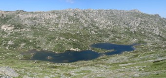
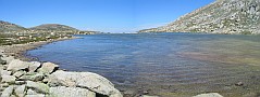
A very shallow water body given its area, Lake Albina is dotted with islands and displays many subtle colours. It was named by Robert von Lendenfeld, an Austrian scientist, after his young daughter who had died in Melbourne. von Lendenfeld was looking for evidence of glaciation in the Alps in the 1880s.
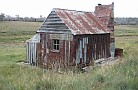
After a rest it’s time to move on. A slight climb out of Northcote Pass takes you along the western face of Mt Lee, where there are old fence lines, evidence of past grazing activities.
13.2 (15.2) km
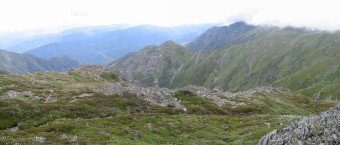
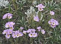
The saddle between Mt Lee and Carruthers Peak is a very bleak place. The wind often brings chilling mists from the west, and clears the rocky ground of snow. The fact that the windswept feldmark plants can survive conditions as harsh as these shows how resilient life can be, and why we should be confident about its ability to regenerate all over KNP after the widespread fires of 2003.
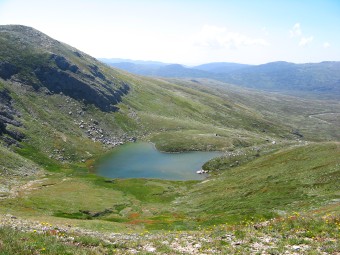
Just past the feldmark is a spot to enjoy the view over the aptly named and exquisitely shaped Club Lake. Try to stay on the track to avoid trampling the vulnerable plants. Club Lake lies below Carruthers Peak, the next highlight on the grand tour.
Carruthers is only 83 metres lower than Kosciuszko, and is approached steeply from the west. The track passes just south of the summit, which gives superb views of the Main Range.
14.3 (16.3) km
The descent of the north-eastern slope of Carruthers presents you with a marvellous view of Watsons Crags, with The Sentinel in the foreground. This rugged spectacle of cliffs and chasms is a far cry from the well-mannered rolling landscape through which you’ve come.
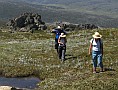
Carruthers suffered considerably from grazing, and you may see evidence of rehabilitation works, including netting, pegs and bitumen. It is still a difficult struggle for the native vegetation. Take a break at Blue Lake lookout (see Walk A4). Contrast its cirque with the other lakes’ shallow bowls. Rest before the last 3.5km downhill leg and the short but gruelling homeward climb.